Today was a lot of catch-up for me. Luckily, I have some incredible individuals who are able to help and assist me. I created my initials utilizing the GPS unit and the tracking application.
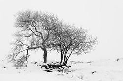
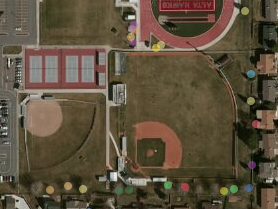
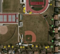
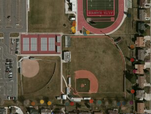
Tree Mapping Project: Using our GPS units, a GoPro, iPads, and ingenuity, we mapped out the trees on the south end of the Alta High School grounds. Trees varied in height, width, and variety.
Some of the trees were slightly tricky to identify and measure. Rather than making a triangle/ratio of measurements in comparison to the shadows, we took the measure of Danae (5'7) walked back till the GPS unit appeared the same size as Danae. Then we simply counted the amount of GPS units till it reached the top. This gave us a fairly accurate estimate of each tree's height.
Stream Side Science is a workbook that has information and lesson plans we can use with our classrooms. It was mentioned that we can get this for free as a PDF online, or talk to Utah State University and pay a mere $16.00 for a hard copy.
Watersheds: During the presentation, I loved the kinesthetic/visual representation of cupping your hands and showing where the water starts (thumbs) and ends (pinkies). ...."we all live downstream."
The 'field trip' to Little Cottonwood Canyon should be fun. Testing the water should be interesting.
Tree Hunt Interactive Map
 RSS Feed